-

A. Overview of the 1970 Flathead Lake Seismic Survey
Robert Lankston
This book describes the evolution of the Wold-Friedel subbottom profiling system that was used during the 1970 reflection seismic survey at Flathead Lake. The book summarizes the key phases of acquisition and use of the reflection seismic data that were collected and describes the evolution ... Read More
-

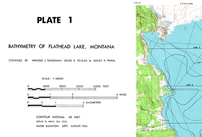
B. Bathymetry and Survey Lines
Arnold J. Silverman, David R. Pevear, and Sidney R. Prahl
Image of blue line copy of original survey track line and bathymetry map. Image editor enhanced version of the image of the copy of the original map.
-

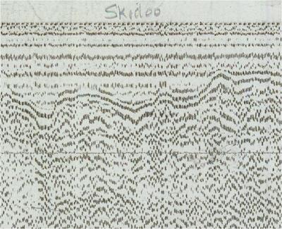
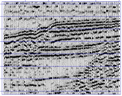
C. Field-Recorded Seismic Sections
Gary W. Crosby and Richard J. Wold
Images of seismic sections from field operations and a description of the scanned sections.
-

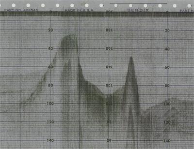
D. Bathymetry Profiles
Gary W. Crosby and Richard J. Wold
Images of original bathymetry profiles from field operations and a description of the images.
-

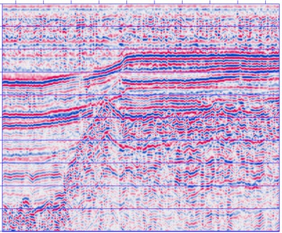
E. Redisplayed Seismic Sections
Sidney R. Prahl
Images of redisplayed seismic data and a description of the redisplayed sections.
-

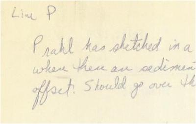
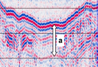
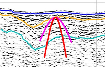
F. Interpretation Cross Sections
Sidney R. Prahl
Images of hand-drawn and computer-drawn interpretation cross-sections and a description of the computer-drawn cross sections.. The cross sections are presumed to be the work of Sidney R. Prahl.
-

G. 1980 Notes on Assessment of the 1970 Data
Anthony Qamar
Images of interpretation notes made in 1980 on the 1970 data and previous interpretations and a narrative describing the notes pages. Notes are presumed to be the work of Anthony Qamar.
-

H. Down-sampling of the Digital Data
Richard L. Hess
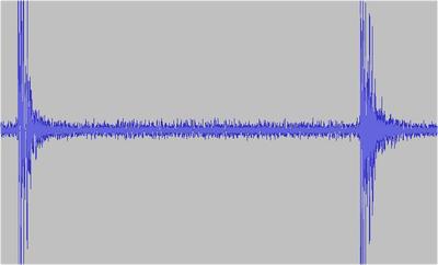
1 kHz and 8 kHz down-sampling of the 48 kHz digitization of the archive tape and descriptions of the tape to .wav file transcriptions.
-

I. Using the Digitized Data
Robert W. Lankston
Log of steps to convert .wav file to SU/SEG-Y formats, sample C code for extracting traces from the downsampled files, and SEG-Y trace files..
-

J. New Display of the 1970 Flathead Lake Seismic Data
Robert W. Lankston
Edited version of the Lankston 2011 Northwest Geology paper that discusses reduction of bubble energy through homomorphic deconvolution and a primer by Lankston on identifying bubble energy phases in the Flathead Lake seismic data.
-

K. Image to Data Trace Files
Robert W. Lankston
Traces files for all survey lines generated by processing the scanned images and a description of the process.
-

L. Dots to Data: Manufacturing Digital Seismic Traces from Scanned Images of the Paper Sign Bit Sections from the 1970 Flathead Lake Seismic Survey
Robert W. Lankston
PowerPoint slides and the recorded audio of a lecture presented by Robert Lankston on October 13, 2014 in the University of Montana, Department of Geosciences Colloquium lecture series.
-

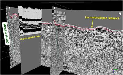
M. Epilogue for the 1970 Flathead Lake Seismic Project Collection
Robert W. Lankston
Re-introduction of the 1980 Qamar-Kogan seismic survey at Flathead Lake with recommendations for building an archive for that project. Article includes a proof-of-concept for converting scanned images of seismic sections recorded in variable density to digital seismic traces.
This reflection seismic survey of Flathead Lake was conducted in August of 1970 and used the University of Montana research station at Yellow Bay, Montana, as a base of operations (another reflection seismic survey was conducted in 1980). The principal investigators of the 1970 survey were Richard Wold and Gary Crosby. The Book A: Overview gives a summary of the 1970 data acquisition, the use of the data in paper form from 1970 to 2005, the use of the data in digital form from 2006 to 2017, and the development of this archive. Scans of the survey line basemap, the seismic and bathymetry sections, the handwritten notes and cross sections, and the digital seismic trace data are in the respective books of this collection. The collection also includes articles describing proof of concept uses of the trace data and images..
Printing is not supported at the primary Gallery Thumbnail page. Please first navigate to a specific Image before printing.